


Distance: 11 km
Duration (average) : 03h
Elevation: 55 D +
Departure: Town Hall
LOOP
Circuits of France_circuits
Circuits of France_POI
Outside
Registered with the PDIPR
As the water flows
Yellow markings
Public transport stop within 500 m
Panoramic view
Bus stop within 500 m
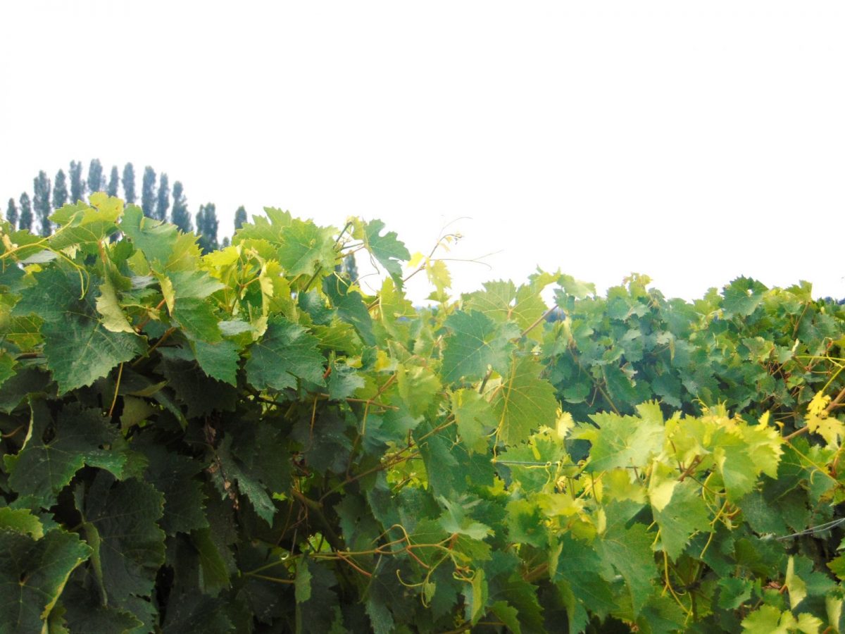
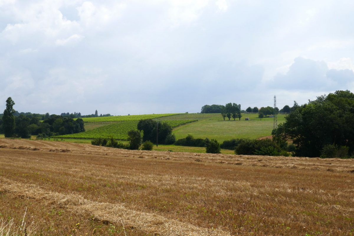
View of the vineyard
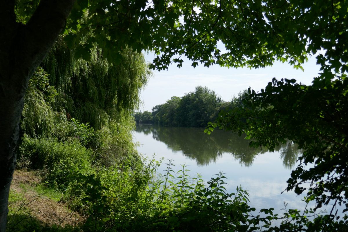
River or river view
In the city
In the historic center
River or river within 300 m
At the water's edge
In the countryside
 Walking
Why we love
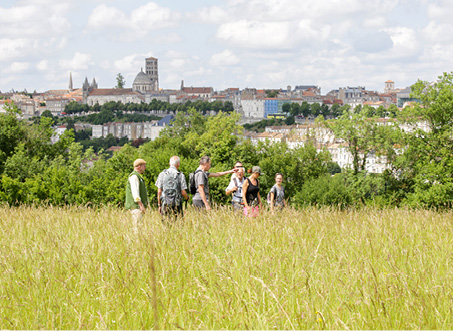
This hike will make you discover a rich architectural heritage, beautiful views of Angoulême, the vineyards, the islands and the shady banks of the Charente.

Your itinerary
1
Step 1
Departure from the town hall - built in 1852 by Jules Durandeau, this private mansion was transformed into a luxurious boarding house from 1918 to 1946 before becoming Town Hall after 1945.
Pass in front of the Notre Dame church - its architecture bears witness to the influence of the Saint-Pierre cathedral, whose vaulting in a row of domes it adopted. The other remarkable element is a set of mural paintings dating from the XNUMXth century. Adjoining the church, the Deanery dating from the XNUMXth and XNUMXth centuries has a very beautiful vaulted room with an interior well and loopholes.
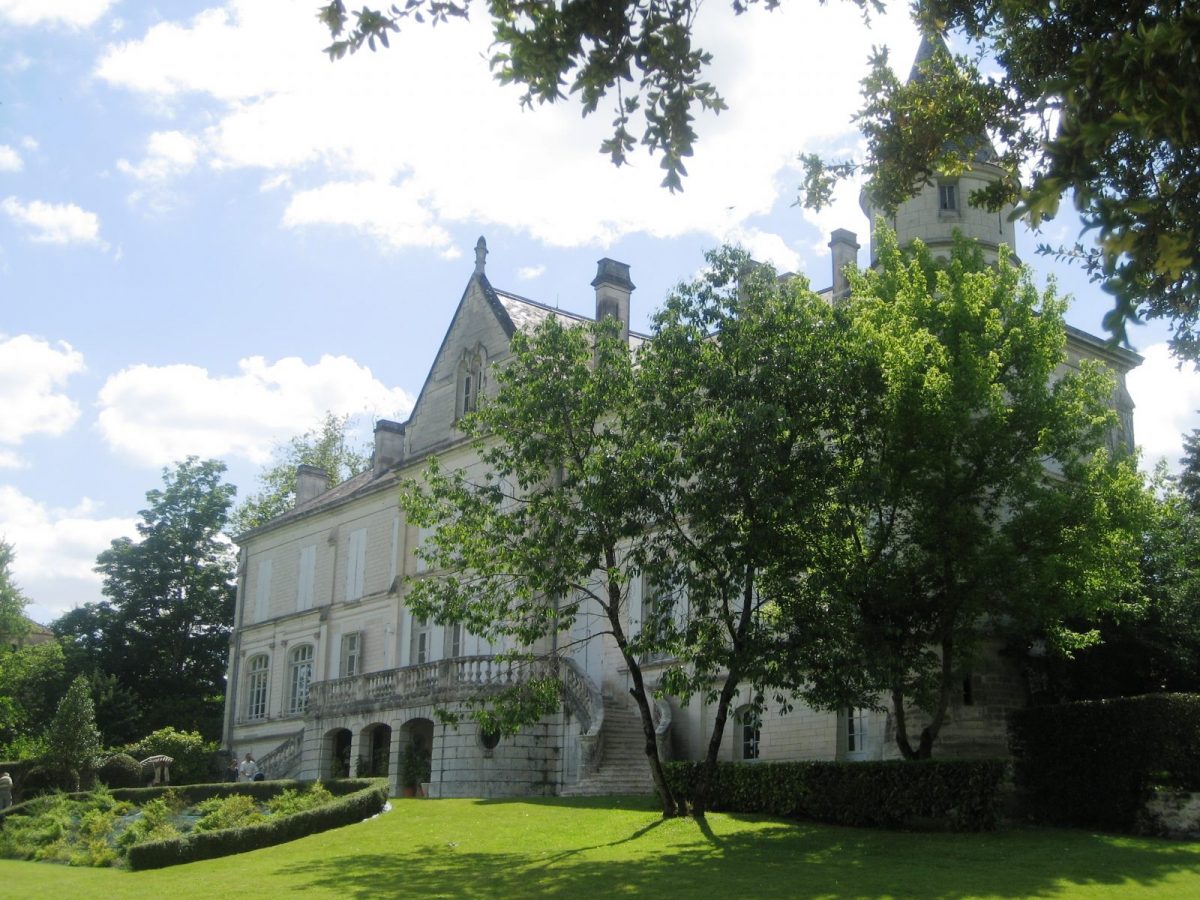
Continue on rue du Château. The castle (1996th century), owned by the town since XNUMX, is now a reception room open for hire.
Turn right into rue Saint Barbe which runs along the Parc du Logis de Chalonne.
Property of the MONTGEON family in the 1997th and XNUMXth centuries, this dwelling was restored by the Marquis de Montalembert in the XNUMXth century. Its last owner bequeathed it with the land to the municipality in XNUMX.
Pass in front of the Notre Dame church - its architecture bears witness to the influence of the Saint-Pierre cathedral, whose vaulting in a row of domes it adopted. The other remarkable element is a set of mural paintings dating from the XNUMXth century. Adjoining the church, the Deanery dating from the XNUMXth and XNUMXth centuries has a very beautiful vaulted room with an interior well and loopholes.
Continue on rue du Château. The castle (1996th century), owned by the town since XNUMX, is now a reception room open for hire.
Turn right into rue Saint Barbe which runs along the Parc du Logis de Chalonne.
Property of the MONTGEON family in the 1997th and XNUMXth centuries, this dwelling was restored by the Marquis de Montalembert in the XNUMXth century. Its last owner bequeathed it with the land to the municipality in XNUMX.
2
Step 2
Turn left into rue des Saules as far as the cemetery – be careful when crossing rue Nouvelle (D103) and rue des Vergnes.
Continue straight along the path that runs alongside the cemetery. From there, you follow the line of ridges offering beautiful views of the vineyard.
Cross the Route de la Combe à Pierrot then the Rue des Bertons. After about 300 m, turn left.
Continue straight along the path that runs alongside the cemetery. From there, you follow the line of ridges offering beautiful views of the vineyard.
Cross the Route de la Combe à Pierrot then the Rue des Bertons. After about 300 m, turn left.
3
Step 3
Take the D120 on the left, turn quickly left and follow the chemin de la Grelière au Godier which goes up to the rue des Bertons. The place called "les Godiers" is located on the site of an ancient Gallo-Roman city which has now disappeared.
Turn left and immediately right to rue de Belfond.
Turn left and immediately right to rue de Belfond.
4
Step 4
Turn right and immediately left between the houses on Chemin des Anglais – section of the old Limoges / Saintes Roman road. It was used by the English to leave Angoulême at the end of the Hundred Years War, hence its name.
5
Step 5
Turn right onto rue des Sablons, then go up rue de Badoris to the right as far as the protected passage. Turn left before rue des Brandes.
Continue in the woods and reach rue de la Touche which takes you to the D72.
Continue in the woods and reach rue de la Touche which takes you to the D72.
6
Step 6
Cross over the pedestrian crossing and follow the protected path to the right until you reach a path on the left.
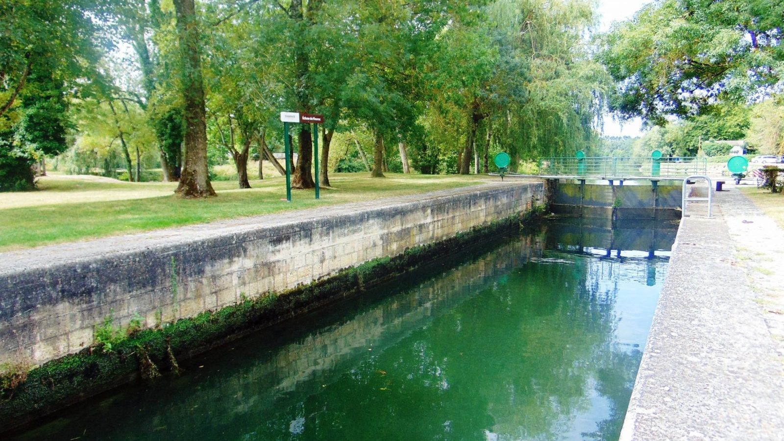
Go down to an intersection, turn right then left on the small road that leads to the Fleurac lock and the Charente islands.
Go down to an intersection, turn right then left on the small road that leads to the Fleurac lock and the Charente islands.
7
Step 7
Take the old towpath called “la Coulée verte” to the left as far as the Basseau bridge. This old ford (Low water) was transformed into a bridge by the Romans who installed a port here. This bridge was for a long time the only one on the Charente before the district of Saint-Cybard. A ferry replaced it in the 1852th century, a suspension bridge in 1894 before the construction of the current bridge in XNUMX.
Follow the Charente for 1.5 km before going up towards the town hall of Fléac.
Follow the Charente for 1.5 km before going up towards the town hall of Fléac.