


Distance: 6 km
Duration (average) : 02h
Departure: Festival Hall
LOOP
Circuits of France_circuits
Outside
Registered with the PDIPR
Red markup
Public transport stop within 500 m
Bus stop within 500 m
GR route within 1 km
Village center
In the countryside
 Walking
Why we love
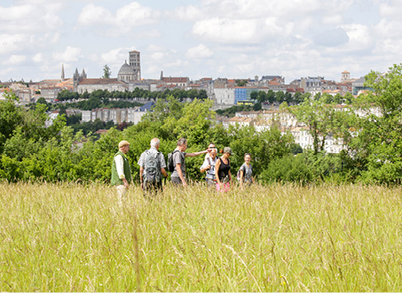
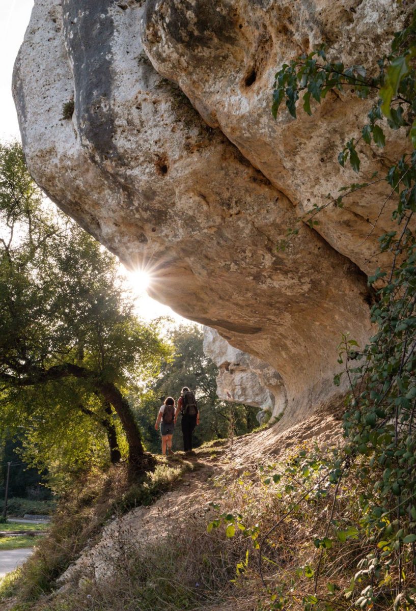
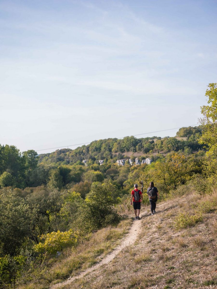
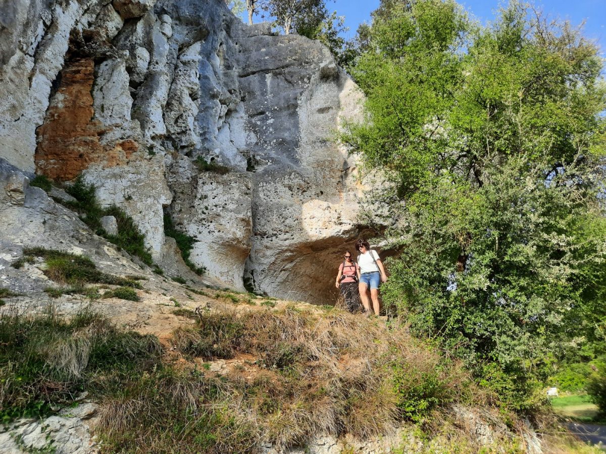
A major and protected natural site, the Eaux-Claires valley is a very popular place to walk, remarkable for its limestone cliffs and its biodiversity.
Your itinerary
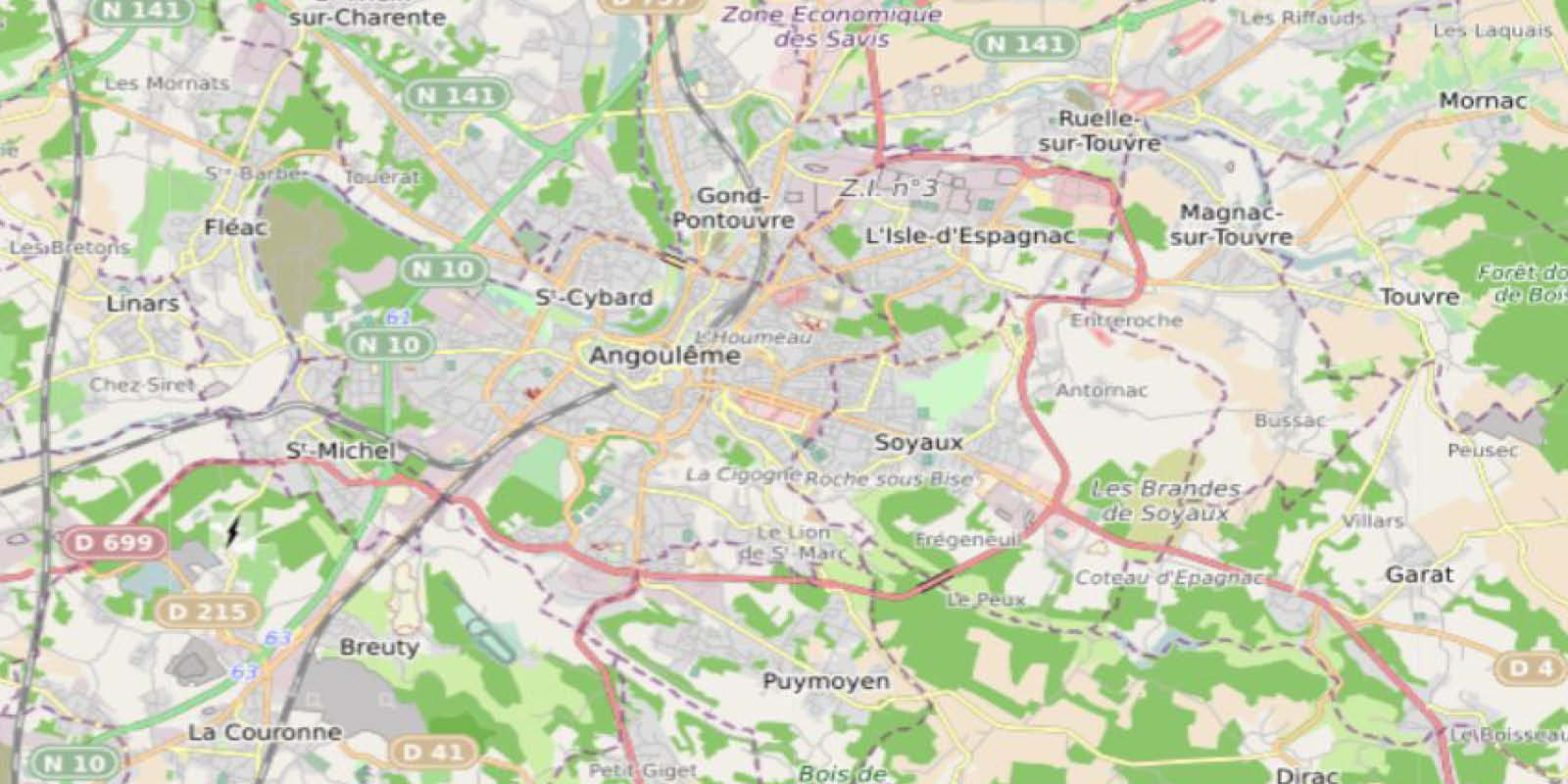
Puymoyen
1
Step 1
Head towards the roundabout where the shops and the town hall are located. Turn right on Rue d'Angoulême, cross at the protected passage to take Rue du Verger. Ignore rue du Souvenir then chemin des Prauds. In the bend, see the cross in front of the house, continue opposite Rue du Bois Jamain.
2
Step 2
Turn left Chemin des Grandes Vignes. On the bend, take the path forbidden to vehicles which descends into the valley. Turn right at the bottom and reach the Route de la Vallée des Eaux-Claires.
3
Step 3
Follow it to the left, cross the Eaux-Claires stream and turn right on the bend, at the corner of the house. Follow this pleasant path until the next intersection – before the second bend, see the spring and its restored wash house.
4
Step 4
Turn left to climb to Mont Riant.
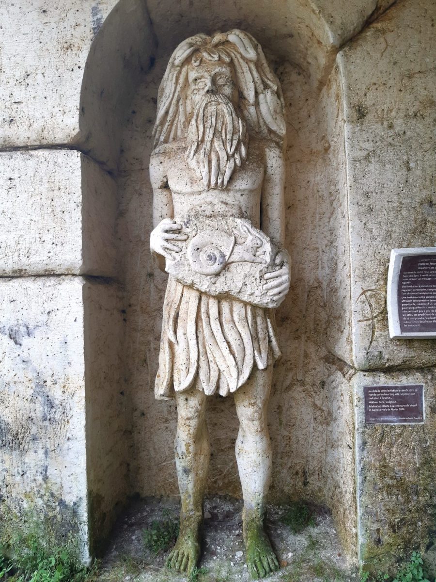
The valley is dug by old underground quarries of cut stone (Angoulême stone) often converted into mushroom houses then abandoned. Off course, see the sculpture on the small road that goes up to Giget.
Pass the deer farm and the equestrian center. At the crossroads, ignore the road going down to follow the one going up opposite. Turn right before the houses.
5
Step 5
In the bend, go down on the left the path along a fenced park. At the bottom, follow the road to the right to the cliffs of the world famous rock climbing site. See the wash house below. Off the route, 300 m to the left is the Moulin du Verger, known for its artisanal paper made in the old-fashioned way and also famous thanks to the saga of Marie-Bernadette Dupuy.
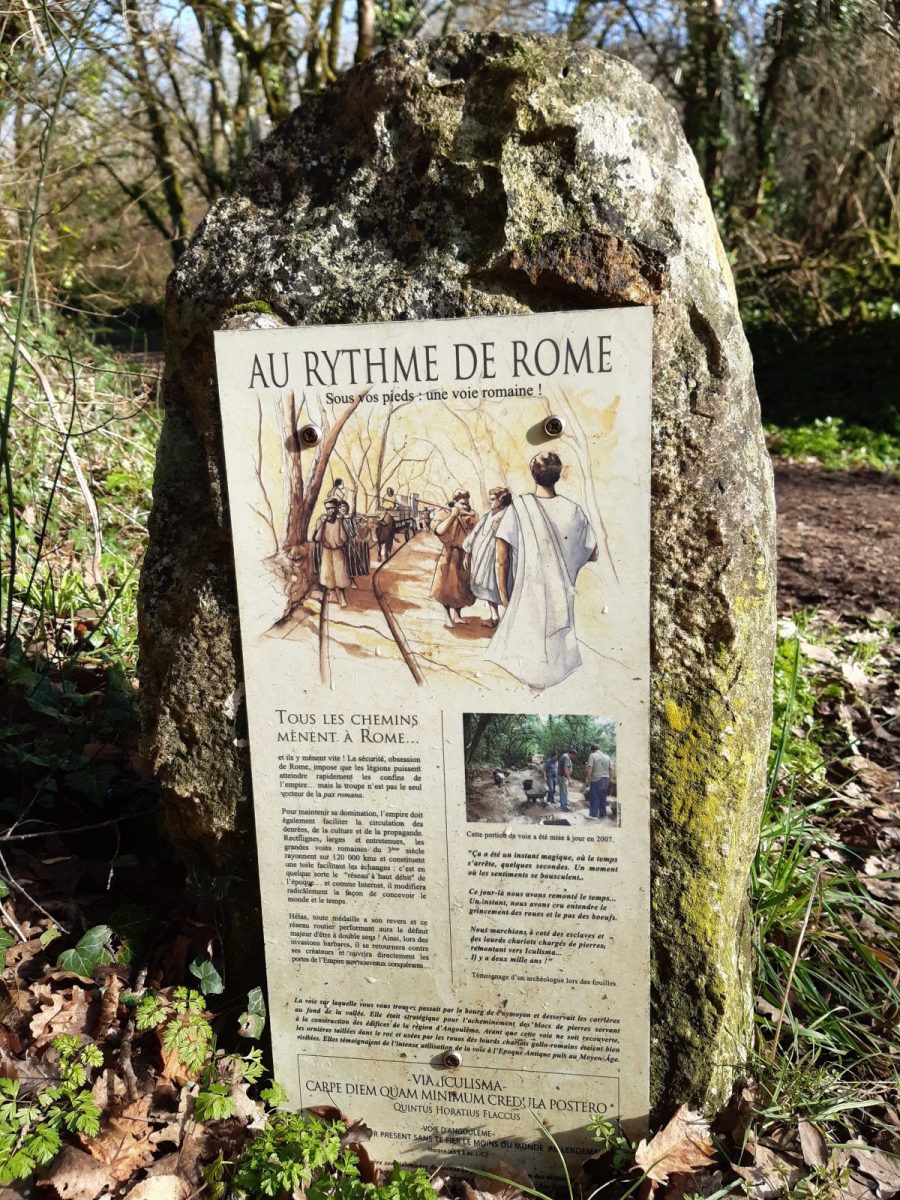
Continue on the road, turn left at the intersection then take the “Iculisma route” which climbs towards Puymoyen – see the marker at the bottom of the path.
Continue on the road, turn left at the intersection then take the “Iculisma route” which climbs towards Puymoyen – see the marker at the bottom of the path.
6
Step 6
Turn left on Rue du Bourg, see the Saint-Vincent church and continue towards the roundabout from where you reach the starting point.